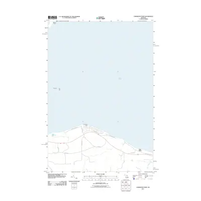
2011 Map of Cordwood Point
USGS Topo · Published 2011About this map
Lake Huron dominates this northern Michigan survey, defining the coastal interface where the Straits of Mackinac meet the open water. The shoreline is punctuated by prominent landforms such as Cordwood Point and the elevated terrain of High Banks, which rise above the surrounding lakefront. Navigation and maritime history are central to this area, evidenced by the presence of Poe Reef and the critical Poe Reef Light offshore.
Find a feature on this map
18 named features on this map. Tap any name to fly to it.
Don’t see what you’re looking for? This feature index may not catch every label — zoom into the map to look around manually.
Map Details
Editions of this 2011 Cordwood Point Map
This is the sole edition of this map. No revisions or reprints were ever made.
Other maps of this area

1955 · Cheboygan
USGS Topo · 1:250,000

1957 · Cheboygan
USGS Topo · 1:62,500

1958 · Cheboygan
USGS Topo · 1:250,000

1958 · Grace
USGS Topo · 1:62,500

1964 · McRae Bay
USGS Topo · 1:24,000

1982 · Cordwood Point
USGS Topo · 1:25,000

1982 · Cheboygan
USGS Topo · 1:25,000

1982 · Grace
USGS Topo · 1:24,000

1982 · Aloha
USGS Topo · 1:25,000
1982 · Nilemile Point
USGS Topo · 1:25,000