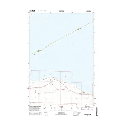
2014 Map of Cordwood Point
USGS Topo · Published 2014About this map
Cordwood Point marks a prominent bend along the northern Michigan shoreline where the Straits of Mackinac meet Lake Huron. This 2014 survey captures a sparsely populated coastal landscape defined by small residential developments and local routes like Cordwood Shores Dr and Ridgeview Dr. The terrain transitions from the shoreline toward the High Banks, while the South Channel and Poe Reef remain critical navigational features for maritime traffic moving through the straits.
Find a feature on this map
27 named features on this map. Tap any name to fly to it.
Don’t see what you’re looking for? This feature index may not catch every label — zoom into the map to look around manually.
Map Details
Editions of this 2014 Cordwood Point Map
This is the sole edition of this map. No revisions or reprints were ever made.
Other maps of this area

1955 · Cheboygan
USGS Topo · 1:250,000

1957 · Cheboygan
USGS Topo · 1:62,500

1958 · Cheboygan
USGS Topo · 1:250,000

1958 · Grace
USGS Topo · 1:62,500

1964 · McRae Bay
USGS Topo · 1:24,000

1982 · Cordwood Point
USGS Topo · 1:25,000

1982 · Cheboygan
USGS Topo · 1:25,000

1982 · Grace
USGS Topo · 1:24,000

1982 · Aloha
USGS Topo · 1:25,000
1982 · Nilemile Point
USGS Topo · 1:25,000