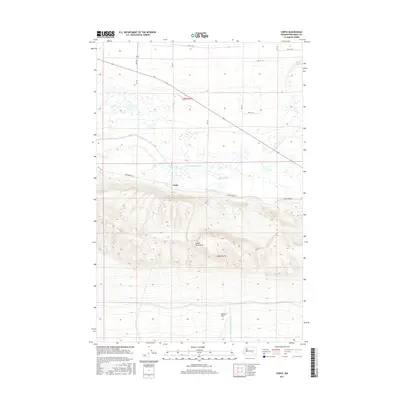
2017 Map of Corfu
USGS Topo · Published 2017About this map
Saddle Mountains dominate the southern half of this landscape, rising sharply above the Wahluke Slope and the marshy basins of Grant Co. to the north. The small settlement of Corfu sits near the base of these heights, positioned where the terrain transitions toward the watercourses of Lower Crab Creek. This area illustrates a complex hydrographic system where natural drainage and irrigation infrastructure meet, evidenced by the White Bluffs Wasteway cutting through the southern slopes. To the northeast, Royal Lake provides a distinct water feature amidst the grid-patterned agricultural roads like RD 14.7 Se and RD 16.6 Se. The map captures the intersection of dramatic geological upheaval and the systematic rural development of central Washington, defined by the stark contrast between the ridgelines and the low-lying wetlands.
Find a feature on this map
16 named features on this map. Tap any name to fly to it.
Don’t see what you’re looking for? This feature index may not catch every label — zoom into the map to look around manually.
Map Details
Editions of this 2017 Corfu Map
This is the sole edition of this map. No revisions or reprints were ever made.
Other maps of this area

1911 · Red Rock
USGS Topo · 1:62,500

1916 · Coyote Rapids
USGS Topo · 1:62,500

1923 · Corfu
USGS Topo · 1:62,500

1924 · Hanford
USGS Topo · 1:62,500

1950 · Smyrna
USGS Topo · 1:62,500

1951 · Smyrna
USGS Topo · 1:62,500

1951 · Corfu
USGS Topo · 1:62,500

1951 · Hanford
USGS Topo · 1:62,500

1951 · Coyote Rapids
USGS Topo · 1:62,500

1953 · Walla Walla
USGS Topo · 1:250,000