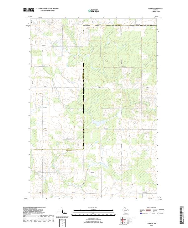
2022 Map of Corinth
USGS Topo · Published 2022About this map
Corinth anchors the southeastern corner of this central Wisconsin landscape, situated where the E Br Big Eau Pleine River winds through a patchwork of agricultural lands and wetlands. The terrain is defined by a dense grid of rural roads, many bearing local family names like Dassow Rd, Frahm Rd, and Weiler Rd. The border between Taylor and Marathon Counties bisects the area horizontally, separating the northern tier of townships from the southern drainage basins. Significant natural features include the Black Cr and the prominent Windfall Hill Rd, which cuts across the eastern upland. The map reveals a highly structured rural economy, where the North American Public Land Survey System creates a rigid framework of sections and townships that guides the placement of every farmstead and thoroughfare.
Find a feature on this map
50 named features on this map. Tap any name to fly to it.
Don’t see what you’re looking for? This feature index may not catch every label — zoom into the map to look around manually.
Map Details
Editions of this 2022 Corinth Map
This is the sole edition of this map. No revisions or reprints were ever made.
Other maps of this area

1902 · Marathon
USGS Topo · 1:125,000

1951 · Athens
USGS Topo · 1:48,000

1951 · Medford
USGS Topo · 1:48,000

1953 · Abbotsford
USGS Topo · 1:48,000

1953 · Stratford
USGS Topo · 1:48,000

1953 · Eau Claire
USGS Topo · 1:250,000

1953 · Rice Lake
USGS Topo · 1:250,000

1958 · Eau Claire
USGS Topo · 1:250,000

1959 · Rice Lake
USGS Topo · 1:250,000

1963 · Stratford
USGS Topo · 1:62,500