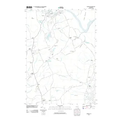
2010 Map of Corinth
USGS Topo · Published 2010About this map
The Hudson River carves through the northern reaches of this Saratoga County landscape, anchoring the industrial and residential centers of Corinth and Palmer. To the south, the terrain transitions into the high ridges of the Palmertown Range and the Luzerne Mountains, defining the natural corridor of Clothier Hollow. This 2010 survey reveals a dense network of family and community history preserved in its numerous burial grounds, such as the Davis-Bedell-Young Cemetery and the Quaker Cemetery near Carp Pond.
Find a feature on this map
98 named features on this map. Tap any name to fly to it.
Don’t see what you’re looking for? This feature index may not catch every label — zoom into the map to look around manually.
Map Details
Editions of this 2010 Corinth Map
This is the sole edition of this map. No revisions or reprints were ever made.
Other maps of this area

1895 · Glens Falls
USGS Topo · 1:62,500

1897 · Glens Falls
USGS Topo · 1:62,500

1900 · Schuylerville
USGS Topo · 1:62,500

1902 · Saratoga
USGS Topo · 1:62,500

1903 · Luzerne
USGS Topo · 1:62,500
1934 · Quaker Springs
USGS Topo · 1:24,000

1934 · Saratoga Springs
USGS Topo · 1:24,000

1935 · Gansevoort
USGS Topo · 1:24,000

1935 · Middle Grove
USGS Topo · 1:24,000

1935 · Corinth
USGS Topo · 1:24,000