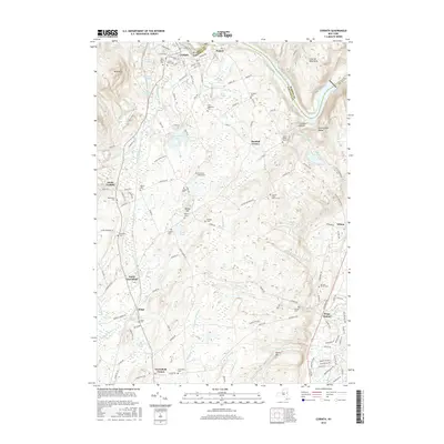
2016 Map of Corinth
USGS Topo · Published 2016About this map
The Hudson River bends sharply around the northern reaches of the Palmertown Range and Luzerne Mountains, anchoring a landscape defined by the historical development of Saratoga and Warren counties. The village of Corinth serves as a primary hub, situated near the riverbanks where industrial and residential streets like Mill St and Wall St meet. To the south, the terrain transitions into the agricultural and wooded uplands of North Greenfield and Greenfield Center.
Find a feature on this map
148 named features on this map. Tap any name to fly to it.
Don’t see what you’re looking for? This feature index may not catch every label — zoom into the map to look around manually.
Map Details
Editions of this 2016 Corinth Map
This is the sole edition of this map. No revisions or reprints were ever made.
Other maps of this area

1895 · Glens Falls
USGS Topo · 1:62,500

1897 · Glens Falls
USGS Topo · 1:62,500

1900 · Schuylerville
USGS Topo · 1:62,500

1902 · Saratoga
USGS Topo · 1:62,500

1903 · Luzerne
USGS Topo · 1:62,500
1934 · Quaker Springs
USGS Topo · 1:24,000

1934 · Saratoga Springs
USGS Topo · 1:24,000

1935 · Gansevoort
USGS Topo · 1:24,000

1935 · Middle Grove
USGS Topo · 1:24,000

1935 · Corinth
USGS Topo · 1:24,000