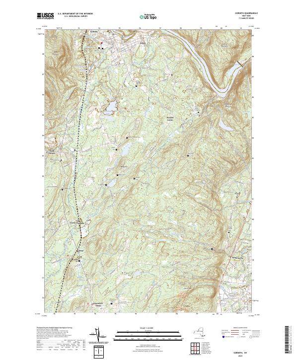
2023 Map of Corinth
USGS Topo · Published 2023About this map
The Hudson River bends sharply through the northern reaches of this Saratoga County landscape, marking the border between Warren Co and Saratoga Co. The village of Corinth and the nearby settlement of Palmer anchor the riverfront, while the southern terrain is defined by the high ridges of the Luzerne Mountains and the Palmertown Range. This modern survey reveals a dense concentration of family and community burial grounds, such as the John Eggleston Cem and Nathan Carpenter Cem, which provide a clear map of 19th and 20th-century kinship across the rural uplands.
Find a feature on this map
148 named features on this map. Tap any name to fly to it.
Don’t see what you’re looking for? This feature index may not catch every label — zoom into the map to look around manually.
Map Details
Editions of this 2023 Corinth Map
This is the sole edition of this map. No revisions or reprints were ever made.
Other maps of this area

1895 · Glens Falls
USGS Topo · 1:62,500

1897 · Glens Falls
USGS Topo · 1:62,500

1900 · Schuylerville
USGS Topo · 1:62,500

1902 · Saratoga
USGS Topo · 1:62,500

1903 · Luzerne
USGS Topo · 1:62,500
1934 · Quaker Springs
USGS Topo · 1:24,000

1934 · Saratoga Springs
USGS Topo · 1:24,000

1935 · Gansevoort
USGS Topo · 1:24,000

1935 · Middle Grove
USGS Topo · 1:24,000

1935 · Corinth
USGS Topo · 1:24,000