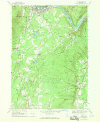
1968 Map of Corinth
USGS Topo · Published 1970About this map
The Hudson River flows along the northern edge of this territory, marking the boundary of the Adirondack State Park. The village of Corinth and the nearby settlement of Palmer sit at the river's bend, where industry and transportation intersect at the Delaware and Hudson RR. Moving south, the landscape transitions into the foothills of the Adirondack Mountains, characterized by numerous water bodies like Lake Bonita, Devils Pond, and the Vly.
Find a feature on this map
83 named features on this map. Tap any name to fly to it.
Don’t see what you’re looking for? This feature index may not catch every label — zoom into the map to look around manually.
Map Details
Editions of this 1968 Corinth Map
This is the sole edition of this map. No revisions or reprints were ever made.
Other maps of this area

1895 · Glens Falls
USGS Topo · 1:62,500

1897 · Glens Falls
USGS Topo · 1:62,500

1900 · Schuylerville
USGS Topo · 1:62,500

1902 · Saratoga
USGS Topo · 1:62,500

1903 · Luzerne
USGS Topo · 1:62,500
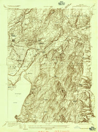
1934 · Quaker Springs
USGS Topo · 1:24,000

1934 · Saratoga Springs
USGS Topo · 1:24,000

1935 · Gansevoort
USGS Topo · 1:24,000

1935 · Middle Grove
USGS Topo · 1:24,000

1935 · Corinth
USGS Topo · 1:24,000