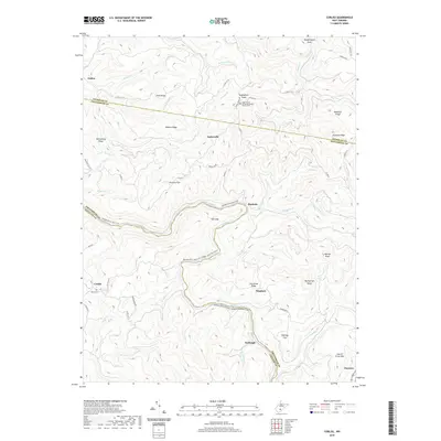
2019 Map of Corliss
USGS Topo · Published 2019About this map
The Meadow River carves a deep, winding path through this corner of the West Virginia mountains, where the borders of Nicholas, Greenbrier, and Fayette counties meet. This 2019 survey captures the landscape as it transitions from its industrial past to a recreational future, most notably through the Meadow River Rail-Trail, which follows the river's bend at The Loop. Small settlements like Nutterville, Burdette, and Bingham are scattered along the ridges and hollows, often defined by local landmarks such as the Sugar Grove United Methodist Church and the adjacent Sugar Grove Cem. The map illustrates the complex topography of the region, from the heights of Laurel Creek Mtn and Beargarden Knob down to the creek beds of Kates Cr and Miller Cr. Genealogists and local historians can trace the network of old county roads, including Corliss Rd and Bingham Rd, that connect these mountain communities.
Find a feature on this map
60 named features on this map. Tap any name to fly to it.
Don’t see what you’re looking for? This feature index may not catch every label — zoom into the map to look around manually.
Map Details
Editions of this 2019 Corliss Map
This is the sole edition of this map. No revisions or reprints were ever made.
Other maps of this area

1887 · Hinton
USGS Topo · 1:125,000

1889 · Nicholas
USGS Topo · 1:125,000

1891 · Nicholas
USGS Topo · 1:125,000

1892 · Hinton
USGS Topo · 1:125,000

1901 · Nicholas
USGS Topo · 1:125,000

1912 · Meadow Creek
USGS Topo · 1:48,000

1914 · Winona
USGS Topo · 1:48,000

1915 · Meadow Creek
USGS Topo · 1:62,500

1916 · Winona
USGS Topo · 1:62,500

1918 · Richwood
USGS Topo · 1:62,500