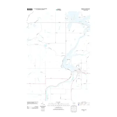
2013 Map of Cornell
USGS Topo · Published 2013About this map
Cornell serves as the focal point of this Chippewa County landscape, situated at the confluence of the Chippewa River and the Fisher River. The town's grid is defined by streets such as Main St and Bridge St, while the surrounding area is heavily defined by its complex hydrography. The massive Holcombe Flowage 4700 dominates the northeast, while Brunet Island sits prominently in the river just west of the city center.
Find a feature on this map
78 named features on this map. Tap any name to fly to it.
Don’t see what you’re looking for? This feature index may not catch every label — zoom into the map to look around manually.
Map Details
Editions of this 2013 Cornell Map
This is the sole edition of this map. No revisions or reprints were ever made.
Other maps of this area

1948 · Weyerhauser
USGS Topo · 1:48,000

1948 · Ladysmith
USGS Topo · 1:48,000

1949 · Bloomer
USGS Topo · 1:62,500

1950 · Weyerhauser
USGS Topo · 1:48,000

1950 · Ladysmith
USGS Topo · 1:48,000

1951 · Bloomer
USGS Topo · 1:62,500

1951 · Cornell
USGS Topo · 1:62,500

1953 · Rice Lake
USGS Topo · 1:250,000

1959 · Rice Lake
USGS Topo · 1:250,000
1971 · Ladysmith SE
USGS Topo · 1:24,000