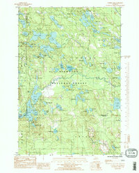
1985 Map of Corner Lake
USGS Topo · Published 1985About this map
The Hiawatha National Forest landscape across the junction of Alger, Delta, and Schoolcraft Counties is defined by an intricate network of glacial lakes and remnants of early industrial infrastructure. In the mid-1980s, the area served primarily as a recreational hub, centered around the Corner Lake Recreation Area and Petes Lake Recreation Area. The hydrography is notably dense, featuring dozens of named water bodies such as Mc Keever Lake, Straits Lake, and the elongated Corner Lake.
Find a feature on this map
77 named features on this map. Tap any name to fly to it.
Don’t see what you’re looking for? This feature index may not catch every label — zoom into the map to look around manually.
Map Details
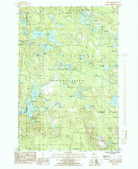
Editions of this 1985 Corner Lake Map
2 editions found
Other maps of this area

1931 · Steuben SW
USGS Topo · 1:31,680

1931 · Shingleton SW
USGS Topo · 1:31,680

1931 · Steuben NW
USGS Topo · 1:31,680

1931 · Skeels Lake NE
USGS Topo · 1:31,680

1931 · Munising SE
USGS Topo · 1:31,680

1932 · Skeels Lake SE
USGS Topo · 1:31,680

1932 · Skeels Lake NW and SW
USGS Topo · 1:31,680

1958 · Corner Lake
USGS Topo · 1:62,500

1958 · Munising
USGS Topo · 1:62,500

1958 · Shingleton
USGS Topo · 1:62,500