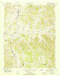
1951 Map of Cornersville
USGS Topo · Published 1951About this map
Cornersville serves as the primary hub of this 1951 topographic survey, situated at the intersection of the Louisville and Nashville railroad and major roadways leading north toward New Town. The landscape is defined by the winding valley of Richland Creek and the prominent elevations of Goshen Ridge and Elk Ridge. Evidence of a settled agricultural and social network is visible in the numerous small communities such as Ostella, Archer, and Diana, along with local landmarks like the County Farm.
Find a feature on this map
81 named features on this map. Tap any name to fly to it.
Don’t see what you’re looking for? This feature index may not catch every label — zoom into the map to look around manually.
Map Details
Editions of this 1951 Cornersville Map
2 editions found
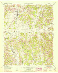
Other maps of this area

1936 · Belfast
USGS Topo · 1:24,000

1936 · Cornersville
USGS Topo · 1:24,000

1936 · Lewisburg
USGS Topo · 1:24,000

1936 · Boonshill
USGS Topo · 1:24,000

1936 · Brick Church
USGS Topo · 1:24,000

1936 · Campbells Station
USGS Topo · 1:24,000

1936 · Petersburg
USGS Topo · 1:24,000

1936 · Tarpley
USGS Topo · 1:24,000

1936 · Frankewing
USGS Topo · 1:24,000

1944 · Shelbyville
USGS Topo · 1:100,000