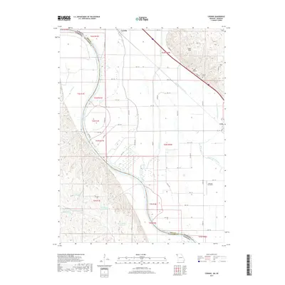
2017 Map of Corning
USGS Topo · Published 2017About this map
The Missouri River defines the border between Missouri and Nebraska on this 2017 survey, carving a wide valley through the floodplain shared by Corning and Craig. To the east, the terrain rises sharply into the loess hills of Pigeon Ridge and the secluded Mill Hollow. This landscape is marked by the complex hydrology of the Tarkio River and its Old Channel, where multiple small reservoirs and lakes like Sims Lake and Lescher Lake have replaced or supplemented the original river course.
Find a feature on this map
60 named features on this map. Tap any name to fly to it.
Don’t see what you’re looking for? This feature index may not catch every label — zoom into the map to look around manually.
Map Details
Editions of this 2017 Corning Map
This is the sole edition of this map. No revisions or reprints were ever made.
Other maps of this area

1915 · Falls City
USGS Topo · 1:62,500

1915 · Nemaha
USGS Topo · 1:62,500

1920 · Craig
USGS Topo · 1:62,500

1936 · Fairfax
USGS Topo · 1:24,000

1939 · Tarkio
USGS Topo · 1:62,500

1939 · Nemaha
USGS Topo · 1:62,500

1940 · Tarkio
USGS Topo · 1:62,500

1941 · Tarkio
USGS Topo · 1:62,500

1949 · Nemaha
USGS Topo · 1:62,500

1955 · Nebraska City
USGS Topo · 1:250,000