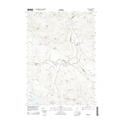
2014 Map of Cornish
USGS Topo · Published 2014About this map
Cornish and the neighboring settlement of West Baldwin occupy a pivotal landscape defined by the confluence of the Ossipee River and Saco River. This 2014 survey reveals an area deeply marked by its early families and local genealogy, with an exceptional density of small burial sites such as the Cotton Burying Ground, Gould Bradeen Cem, and Day Hill Cem. The topography is dominated by numerous named peaks including Bill Merrill Mountain, Mountain Misery, and Mountain Cutler, which overlook a network of rural roads like Sokokis Trl and New Settlement Rd. To the west, the village of Durgintown sits near Wadsworth Brook, while the southern reaches feature several ponds including Long Pond and Noahs Pond. This map serves as an essential record for tracing family names across the terrain, where boundaries for Oxford, York, and Cumberland counties meet.
Find a feature on this map
114 named features on this map. Tap any name to fly to it.
Don’t see what you’re looking for? This feature index may not catch every label — zoom into the map to look around manually.
Map Details
Editions of this 2014 Cornish Map
This is the sole edition of this map. No revisions or reprints were ever made.
Other maps of this area

1891 · Buxton
USGS Topo · 1:62,500

1891 · Newfield
USGS Topo · 1:62,500

1892 · Buxton
USGS Topo · 1:62,500

1893 · Buxton
USGS Topo · 1:62,500

1893 · Newfield
USGS Topo · 1:62,500

1896 · Sebago
USGS Topo · 1:62,500

1910 · Kezar Falls
USGS Topo · 1:48,000

1911 · Kezar Falls
USGS Topo · 1:62,500

1933 · Newfield
USGS Topo · 1:48,000

1937 · Newfield
USGS Topo · 1:62,500