1964 Map of Cornucopia
USGS Topo · Published 1965About this map
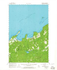
The southern shoreline of Lake Superior dominates this mid-1960s survey, where the fishing village of Cornucopia serves as a primary hub for the South Shore region. The topography transitions from the dramatic points of the Apostle Islands, specifically Eagle Island and its surrounding Eagle Island Shoals, to the densely wooded interior of the Chequamegon National Forest. Settlement patterns are defined by the lake's influence, with Bark Point and Roman Point framing the deep waters of Bark Bay and Siskiwit Bay.
Find a feature on this map
40 named features on this map. Tap any name to fly to it.
Don’t see what you’re looking for? This feature index may not catch every label — zoom into the map to look around manually.
Map Details
Editions of this 1964 Cornucopia Map
This is the sole edition of this map. No revisions or reprints were ever made.
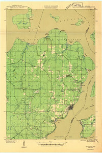
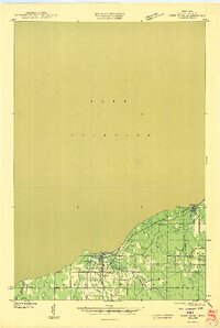
Other maps of this area

1941 · Bayfield
USGS Topo · 1:48,000

1942 · Ashland
USGS Topo · 1:48,000

1943 · Port Wing
USGS Topo · 1:48,000

1943 · Iron Lake
USGS Topo · 1:48,000

1944 · Moquah
USGS Topo · 1:48,000

1944 · Cornucopia
USGS Topo · 1:48,000

1946 · Cornucopia
USGS Topo · 1:48,000
1946 · Bayfield
USGS Topo · 1:48,000
1946 · Port Wing
USGS Topo · 1:48,000

1947 · Moquah
USGS Topo · 1:48,000