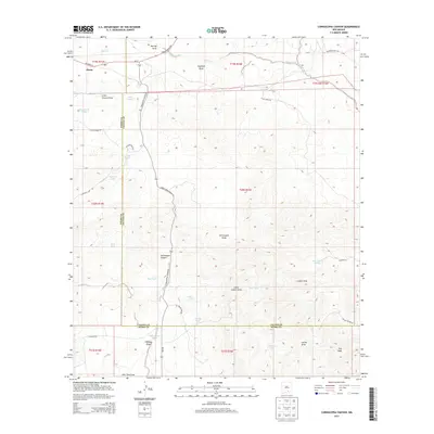
2013 Map of Cornucopia Canyon
USGS Topo · Published 2013About this map
Pinon stands at the northwestern edge of this high-country landscape, where the Chaves County and Otero County lines intersect. The terrain is defined by a dense network of seasonal drainages and canyons, most notably Cornucopia Canyon and the winding Cornucopia Draw. In this arid environment, water management is the primary marker of human activity. The map reveals numerous family-named stock tanks and water features such as Alva Smith Tanks, Herrington Tank, and John Gentry Tank, which are essential to the ranching economy of this portion of New Mexico. Transport is dictated by the land's contours, with Highway 24 and NM-506 providing the main passage through the hills. To the south, Dry Peak and the Collins Hills rise above a complex system of draws, including Little Collins Draw and Fleming Draw, illustrating the remote and specialized nature of land use in this high desert region.
Find a feature on this map
51 named features on this map. Tap any name to fly to it.
Don’t see what you’re looking for? This feature index may not catch every label — zoom into the map to look around manually.
Map Details
Editions of this 2013 Cornucopia Canyon Map
This is the sole edition of this map. No revisions or reprints were ever made.
Other maps of this area

1954 · Carlsbad
USGS Topo · 1:250,000

1958 · Carlsbad
USGS Topo · 1:250,000

1963 · Cornucopia Canyon
USGS Topo · 1:24,000

1963 · Tanner Ranch
USGS Topo · 1:24,000

1963 · Indian Draw
USGS Topo · 1:24,000

1965 · Chimney Lake
USGS Topo · 1:24,000

1965 · Lewis Peak
USGS Topo · 1:24,000

1965 · Avis
USGS Topo · 1:24,000

1965 · Pinon
USGS Topo · 1:24,000

1965 · Pinon Ranch
USGS Topo · 1:24,000