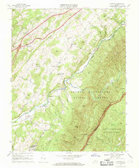
1967 Map of Cornwall
USGS Topo · Published 1969About this map
South Mountain and the Blue Ridge dominate the landscape of Rockbridge County in this late 1960s survey, where the South River carves a path through the George Washington National Forest. The settlement of Cornwall sits at the confluence of Irish Creek and the river, serving as a focal point for a region defined by scattered mountain communities like Blacksburg and Donaldsburg. The infrastructure of the era is clearly marked, from the industrial presence of the Norfolk and Western Railway to the winding scenic route of the Blue Ridge Parkway along the eastern heights.
Find a feature on this map
71 named features on this map. Tap any name to fly to it.
Don’t see what you’re looking for? This feature index may not catch every label — zoom into the map to look around manually.
Map Details
Editions of this 1967 Cornwall Map
3 editions found
Other maps of this area

1894 · Lexington
USGS Topo · 1:125,000

1932 · Lexington
USGS Topo · 1:48,000

1935 · Buena Vista
USGS Topo · 1:48,000

1935 · Amherst
USGS Topo · 1:48,000

1936 · Vesuvius
USGS Topo · 1:48,000

1937 · Lexington
USGS Topo · 1:62,500

1939 · Amherst
USGS Topo · 1:62,500

1939 · Buena Vista
USGS Topo · 1:62,500

1940 · Buena Vista
USGS Topo · 1:62,500

1941 · Vesuvius
USGS Topo · 1:62,500