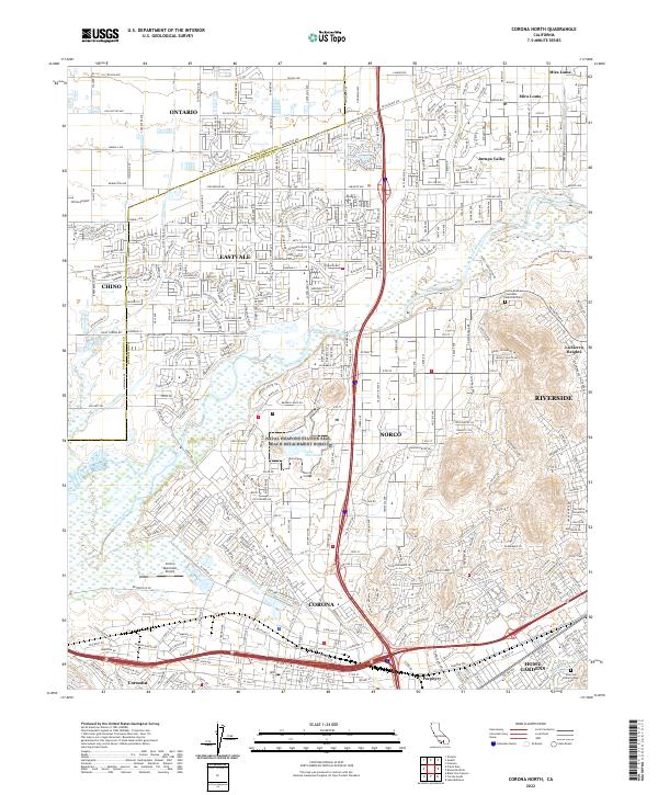
2022 Map of Corona North
USGS Topo · Published 2022About this map
The Santa Ana River winds through this heavily developed region of the Inland Empire, defining the boundaries between several established communities during the early 2020s. Centered on Norco and Corona, the map reveals a landscape where equestrian-oriented neighborhoods and sprawling residential tracts meet significant institutional grounds like Norco College and La Sierra University. To the north, Eastvale and Jurupa Valley show dense modern suburbanization, while the presence of Lake Norconian and the Riverside Canal reflect long-standing water management systems in this part of Riverside County. Aviation activity is prominent at the margins, with Chino Airport to the west and the Corona Municipal Airport tucked near the riverbanks. For genealogists and local historians, several landmarks offer research value, including the Pierce Brothers Crestlawn Memorial Park and the Sherman Indian School Cem near Home Gardens.
Find a feature on this map
49 named features on this map. Tap any name to fly to it.
Don’t see what you’re looking for? This feature index may not catch every label — zoom into the map to look around manually.
Map Details
Editions of this 2022 Corona North Map
This is the sole edition of this map. No revisions or reprints were ever made.
Other maps of this area

1896 · San Bernardino
USGS Topo · 1:62,500

1897 · Cucamonga
USGS Topo · 1:62,500

1898 · San Bernardino
USGS Topo · 1:62,500

1900 · Cucamonga
USGS Topo · 1:62,500

1901 · Southern California Sheet No. 1
USGS Topo · 1:250,000

1901 · San Bernardino
USGS Topo · 1:62,500

1901 · Elsinore
USGS Topo · 1:125,000

1901 · Riverside
USGS Topo · 1:62,500

1902 · Corona
USGS Topo · 1:125,000

1903 · Cucamonga
USGS Topo · 1:62,500