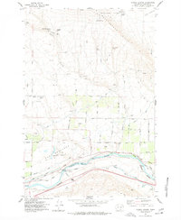
1977 Map of Corral Canyon
USGS Topo · Published 1977About this map
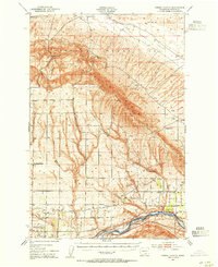
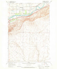
The Rattlesnake Hills descend into a complex landscape of agricultural water management and infrastructure in this mid-1970s survey of Benton County. The northern portion is dominated by the Hanford Works boundary and family-named landmarks like Hodges Ranch and Katie Fleck Spring, while the southern reaches follow the curve of the Yakima River. This river corridor serves as a vital utility hub, featuring the Diversion Dam, the Chandler Power and Pumping Plant, and the Burlington Northern railroad line.
Find a feature on this map
52 named features on this map. Tap any name to fly to it.
Don’t see what you’re looking for? This feature index may not catch every label — zoom into the map to look around manually.
Map Details
Editions of this 1977 Corral Canyon Map
This is the sole edition of this map. No revisions or reprints were ever made.
Other maps of this area

1915 · Prosser
USGS Topo · 1:125,000

1917 · Pasco
USGS Topo · 1:125,000

1917 · Prosser
USGS Topo · 1:125,000

1951 · Richland
USGS Topo · 1:62,500
1951 · Corral Canyon
USGS Topo · 1:62,500

1953 · Walla Walla
USGS Topo · 1:250,000

1958 · Walla Walla
USGS Topo · 1:250,000
1965 · Whitstran
USGS Topo · 1:62,500
1965 · Weber Canyon
USGS Topo · 1:24,000
1965 · Whitstran
USGS Topo · 1:24,000