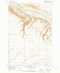
1965 Map of Weber Canyon
USGS Topo · Published 1966About this map
The sharp descent of Mc Bee Grade and the prominent Goose Hill define the northern landscape of this Benton County region during the mid-1960s. This survey illustrates a highly developed water management system for local agriculture, featuring the Kennewick Main Canal and the Webber Canyon Canal winding along the base of the Horse Heaven Hills. Near the settlement of Kiona, the infrastructure supports a dryland and irrigated farming economy, with a scattered Grain Elevator and a central Fire Station serving the rural population.
Find a feature on this map
20 named features on this map. Tap any name to fly to it.
Don’t see what you’re looking for? This feature index may not catch every label — zoom into the map to look around manually.
Map Details
Editions of this 1965 Weber Canyon Map
This is the sole edition of this map. No revisions or reprints were ever made.
Other maps of this area

1915 · Prosser
USGS Topo · 1:125,000

1917 · Pasco
USGS Topo · 1:125,000

1917 · Prosser
USGS Topo · 1:125,000

1951 · Richland
USGS Topo · 1:62,500

1951 · Corral Canyon
USGS Topo · 1:62,500

1953 · Walla Walla
USGS Topo · 1:250,000

1958 · Walla Walla
USGS Topo · 1:250,000

1965 · Whitstran
USGS Topo · 1:62,500
1965 · Prior Ranch
USGS Topo · 1:24,000
1965 · Whitstran SE
USGS Topo · 1:24,000