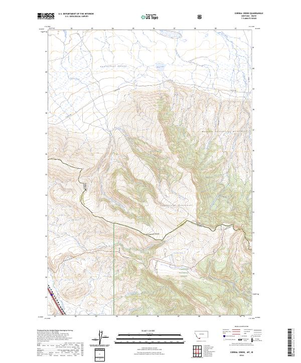
2024 Map of Corral Creek
USGS Topo · Published 2024About this map
Centennial Valley dominates the northern reaches of this map, transitioning into the steep, high-elevation Western Centennial Mountains. The landscape is a vital corridor for conservation, split between the Red Rock Lakes National Wildlife Refuge in the north and the Targhee National Forest to the south. This division is marked physically by the Continental Divide, which snakes across the heights and serves as the state boundary between Montana and Idaho.
Find a feature on this map
35 named features on this map. Tap any name to fly to it.
Don’t see what you’re looking for? This feature index may not catch every label — zoom into the map to look around manually.
Map Details
Editions of this 2024 Corral Creek Map
This is the sole edition of this map. No revisions or reprints were ever made.
Other maps of this area

1955 · Dubois
USGS Topo · 1:250,000

1957 · Paul Reservoir
USGS Topo · 1:62,500

1958 · Dubois
USGS Topo · 1:250,000

1968 · Corral Creek
USGS Topo · 1:24,000

1968 · Big Table Mountain
USGS Topo · 1:24,000

1968 · Lima Dam
USGS Topo · 1:24,000

1968 · Antelope Peak
USGS Topo · 1:24,000

1968 · Monida
USGS Topo · 1:24,000
1968 · Wolverine Creek
USGS Topo · 1:24,000

1972 · Spencer North
USGS Topo · 1:24,000