
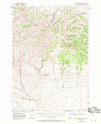
1957 Map of Paul Reservoir
USGS Topo · Published 1959About this map
The Continental Divide serves as the literal and topographic backbone of this survey, defining the rugged high-country boundary between Montana and Idaho. Situated within the Beaverhead National Forest and Targhee National Forest, the landscape transitions from the jagged peaks of the Beaverhead Mountains down into the high-altitude grazing lands of Pleasant Valley. Evidence of the region’s early ranching and resource economy is visible in the solitary Gleed Cow Camp. and a lonely Coal Mine tucked into the northern slopes. Water management in this arid alpine environment is anchored by Paul Reservoir, which collects runoff from Modoc Creek and Kettle Gulch. To the south, the terrain opens into broader drainages where Medicine Lodge Creek flows past a remote Cemetery, marking the sparse but persistent human presence in these remote reaches of Clark County.
Find a feature on this map
57 named features on this map. Tap any name to fly to it.
Don’t see what you’re looking for? This feature index may not catch every label — zoom into the map to look around manually.
Map Details
Editions of this 1957 Paul Reservoir Map
2 editions found
Other maps of this area

1955 · Dubois
USGS Topo · 1:250,000

1957 · Edie Ranch
USGS Topo · 1:62,500

1958 · Dubois
USGS Topo · 1:250,000

1964 · Dubois NW
USGS Topo · 1:24,000

1964 · Lone Butte
USGS Topo · 1:24,000

1964 · Small
USGS Topo · 1:24,000

1965 · Lima Peaks
USGS Topo · 1:24,000

1968 · Corral Creek
USGS Topo · 1:24,000

1968 · Snowline
USGS Topo · 1:24,000

1968 · Monida
USGS Topo · 1:24,000