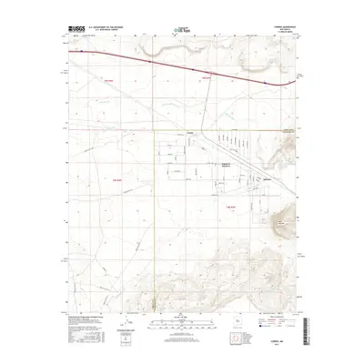
2017 Map of Correo
USGS Topo · Published 2017About this map
Correo and Highland Meadows sit at a significant geographical and historical crossroads in Valencia County, where the path of Old Hwy 66 follows the natural drainage of the Rio San Jose. The landscape is defined by its arid water management and indigenous route networks, evidenced by a series of cisterns and arroyos such as Valentine Tank, East Tank, and Arroyo Lucero. To the east, Suwanee marks a point of transition near the Cibola and Valencia County line. The terrain rises toward the distinct landform of Mesa Redonda in the southeast, while numerous Bureau of Indian Affairs routes, including Indian Svc Rte 544 and Indian Svc Rte 547, crisscross the western sections. This map documents a high-desert environment where modern transportation corridors and traditional land use patterns overlap near sources like Coyote Spring and Suwanee Spring.
Find a feature on this map
64 named features on this map. Tap any name to fly to it.
Don’t see what you’re looking for? This feature index may not catch every label — zoom into the map to look around manually.
Map Details
Editions of this 2017 Correo Map
This is the sole edition of this map. No revisions or reprints were ever made.
Other maps of this area

1883 · Mt. Taylor
USGS Topo · 1:250,000

1886 · Mt. Taylor
USGS Topo · 1:250,000

1892 · Mt. Taylor
USGS Topo · 1:250,000

1899 · Mt. Taylor
USGS Topo · 1:250,000

1917 · Cerro Verde
USGS Topo · 1:125,000

1954 · South Garcia
USGS Topo · 1:24,000

1954 · South Garcia SE
USGS Topo · 1:24,000

1954 · Canoncito School
USGS Topo · 1:24,000

1954 · Socorro
USGS Topo · 1:250,000

1956 · South Garcia
USGS Topo · 1:62,500