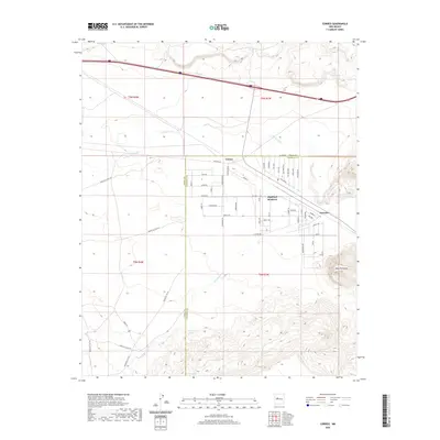
2020 Map of Correo
USGS Topo · Published 2020About this map
Highland Meadows serves as the primary residential hub in this corner of the New Mexico landscape, characterized by a structured grid of streets such as Highland Blvd and Archway Blvd that contrast with the surrounding high desert. The geography is defined by the drainage of Rio San Jose and numerous ephemeral washes like Arroyo Lucero and Arroyo Colorado that carve through the arid terrain. Historical transit remains a visible layer of the landscape, where Old Hwy 66 parallels the modern path of I-40, passing near the small settlements of Correo and Suwanee. To the east, the prominent elevation of Mesa Redonda rises above the valley floor, while isolated water sources such as Suwanee Spring and Coyote Spring provide vital landmarks in a region where water management is marked by features like Valentine Tank and East Tank.
Find a feature on this map
66 named features on this map. Tap any name to fly to it.
Don’t see what you’re looking for? This feature index may not catch every label — zoom into the map to look around manually.
Map Details
Editions of this 2020 Correo Map
This is the sole edition of this map. No revisions or reprints were ever made.
Other maps of this area

1883 · Mt. Taylor
USGS Topo · 1:250,000

1886 · Mt. Taylor
USGS Topo · 1:250,000

1892 · Mt. Taylor
USGS Topo · 1:250,000

1899 · Mt. Taylor
USGS Topo · 1:250,000

1917 · Cerro Verde
USGS Topo · 1:125,000

1954 · South Garcia
USGS Topo · 1:24,000

1954 · South Garcia SE
USGS Topo · 1:24,000

1954 · Canoncito School
USGS Topo · 1:24,000

1954 · Socorro
USGS Topo · 1:250,000

1956 · South Garcia
USGS Topo · 1:62,500