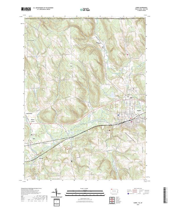
2023 Map of Corry
USGS Topo · Published 2023About this map
The city of Corry and its surrounding rural townships sit at the nexus of the New York-Pennsylvania state line, characterized by a complex drainage network feeding the South Branch French Creek. The landscape transition from the high point of Carter Hill down through the valleys of Spencer Creek and Hare Creek reveals a persistent pattern of dairy-era farm roads and small crossroads settlements.
Find a feature on this map
107 named features on this map. Tap any name to fly to it.
Don’t see what you’re looking for? This feature index may not catch every label — zoom into the map to look around manually.
Map Details
Editions of this 2023 Corry Map
This is the sole edition of this map. No revisions or reprints were ever made.
Other maps of this area

1905 · Clymer
USGS Topo · 1:62,500

1913 · North East
USGS Topo · 1:62,500

1915 · North East
USGS Topo · 1:62,500

1929 · Corry
USGS Topo · 1:48,000

1929 · Union City
USGS Topo · 1:62,500

1932 · Corry
USGS Topo · 1:62,500

1932 · Union City
USGS Topo · 1:62,500

1939 · Clymer
USGS Topo · 1:62,500

1941 · Clymer
USGS Topo · 1:62,500

1943 · North East
USGS Topo · 1:62,500