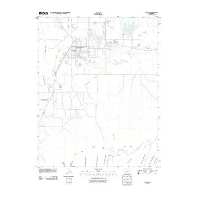
2010 Map of Cortez
USGS Topo · Published 2010About this map
The city of Cortez serves as the focal point for this 2010 topographic survey, sitting at the junction of the Montezuma Valley and the northern reaches of Mesa Verde. The landscape around the city is a hybrid of high-desert terrain and an intricate irrigation network, characterized by the Rocky Ford Ditch and Highline Ditch that feed the surrounding agricultural land. To the north and east, reservoirs like Totten Lake and Denny Lake provide critical water management and recreation near the Conquistador Golf Course.
Find a feature on this map
63 named features on this map. Tap any name to fly to it.
Don’t see what you’re looking for? This feature index may not catch every label — zoom into the map to look around manually.
Map Details
Editions of this 2010 Cortez Map
This is the sole edition of this map. No revisions or reprints were ever made.
Other maps of this area

1912 · Soda Canyon
USGS Topo · 1:62,500

1915 · Soda Canyon
USGS Topo · 1:62,500

1956 · Cortez
USGS Topo · 1:250,000

1958 · Cortez SW
USGS Topo · 1:24,000

1958 · Cortez
USGS Topo · 1:250,000

1959 · Cortez
USGS Topo · 1:250,000

1962 · Cortez
USGS Topo · 1:250,000

1965 · Cortez
USGS Topo · 1:24,000

1965 · Dolores East
USGS Topo · 1:24,000

1965 · Dolores West
USGS Topo · 1:24,000