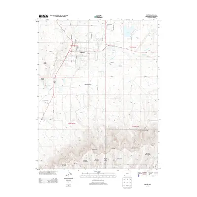
2013 Map of Cortez
USGS Topo · Published 2013About this map
Cortez serves as the primary hub in the Montezuma Valley, shown here in a period of modern expansion. The town grid is clearly defined by historical thoroughfares like E Montezuma Ave and E Main St, with the Cortez Cem and Cortez Municipal Airport marking its perimeter. To the south, the landscape rises dramatically into the northern reaches of Mesa Verde National Park, where sheer geographical features like Krueger Point and North Rim dominate the high mesa. The area's agricultural lifeblood is visible through an intricate network of irrigation, including the Highline Ditch and Rocky Ford Ditch, which channel water across the valley. From the residential streets of the city to the deep drainage of McElmo Canyon, this survey illustrates the intersection of high-desert settlement and massive geological landforms.
Find a feature on this map
87 named features on this map. Tap any name to fly to it.
Don’t see what you’re looking for? This feature index may not catch every label — zoom into the map to look around manually.
Map Details
Editions of this 2013 Cortez Map
This is the sole edition of this map. No revisions or reprints were ever made.
Other maps of this area

1912 · Soda Canyon
USGS Topo · 1:62,500

1915 · Soda Canyon
USGS Topo · 1:62,500

1956 · Cortez
USGS Topo · 1:250,000

1958 · Cortez SW
USGS Topo · 1:24,000

1958 · Cortez
USGS Topo · 1:250,000

1959 · Cortez
USGS Topo · 1:250,000

1962 · Cortez
USGS Topo · 1:250,000

1965 · Cortez
USGS Topo · 1:24,000

1965 · Dolores East
USGS Topo · 1:24,000

1965 · Dolores West
USGS Topo · 1:24,000