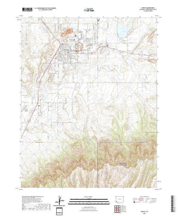
2022 Map of Cortez
USGS Topo · Published 2022About this map
The Montezuma County Courthouse stands as the central landmark for the city of Cortez, a high-desert hub defined by its proximity to ancient landscapes. To the south, the terrain transforms as it enters Mesa Verde National Park, where dramatic formations like Wetherill Mesa and North Rim overlook the deep incisions of West Fork Navajo Canyon and East Fork Horse Canyon. The map reveals a complex agricultural water network essential to the region, including the Rocky Ford Ditch and Highline Ditch, which provide irrigation across the arid plateaus. Recreational and civic spaces are well-documented, from the tranquil waters of Totten Lake and Denny Lake to the north, to the Cortez Municipal Airport on the western edge. This contemporary survey captures the transition between the modern city grid and the protected canyons of the ancestral Puebloan lands.
Find a feature on this map
124 named features on this map. Tap any name to fly to it.
Don’t see what you’re looking for? This feature index may not catch every label — zoom into the map to look around manually.
Map Details
Editions of this 2022 Cortez Map
This is the sole edition of this map. No revisions or reprints were ever made.
Other maps of this area

1912 · Soda Canyon
USGS Topo · 1:62,500

1915 · Soda Canyon
USGS Topo · 1:62,500

1956 · Cortez
USGS Topo · 1:250,000

1958 · Cortez SW
USGS Topo · 1:24,000

1958 · Cortez
USGS Topo · 1:250,000

1959 · Cortez
USGS Topo · 1:250,000

1962 · Cortez
USGS Topo · 1:250,000

1965 · Cortez
USGS Topo · 1:24,000

1965 · Dolores East
USGS Topo · 1:24,000

1965 · Dolores West
USGS Topo · 1:24,000