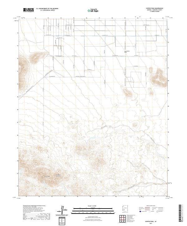
2021 Map of Cortez Peak
USGS Topo · Published 2021About this map
The Gila Bend Mountains dominate the southern portion of this landscape, rising sharply above the desert floor at Cortez Peak. This rugged arid terrain is defined by a complex network of seasonal drainage channels, including the prominent Fourth of July Wash, Yellow Medicine Wash, and Buttermilk Wash, which carve through the foothills before reaching the flatter expanses to the north.
Find a feature on this map
26 named features on this map. Tap any name to fly to it.
Don’t see what you’re looking for? This feature index may not catch every label — zoom into the map to look around manually.
Map Details
Editions of this 2021 Cortez Peak Map
This is the sole edition of this map. No revisions or reprints were ever made.
Other maps of this area

1927 · Hyder
USGS Topo · 1:62,500

1930 · Hyder
USGS Topo · 1:62,500

1942 · Vicksburg
USGS Topo · 1:250,000

1951 · Dendora Valley
USGS Topo · 1:62,500

1954 · Phoenix
USGS Topo · 1:250,000

1957 · Phoenix
USGS Topo · 1:250,000

1958 · Phoenix
USGS Topo · 1:250,000

1960 · Phoenix
USGS Topo · 1:250,000

1962 · Cortez Peak
USGS Topo · 1:62,500

1962 · Eagletail Mts
USGS Topo · 1:62,500