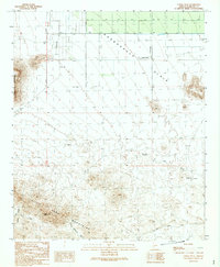
1989 Map of Cortez Peak
USGS Topo · Published 1990About this map
Cortez Peak dominates the southern skyline of this desert landscape where the Gila Bend Mountains meet the Harquahala Plain. The 1980s terrain is defined by extreme aridity and isolation, evidenced by the proliferation of water infrastructure such as a prominent Pipeline and numerous Well sites scattered across the northern flats. In the more varied relief of the Copper Valley, historical resource extraction is visible through markings for Mine Shafts and an Adit, alongside a lonely Prospect to the east.
Find a feature on this map
18 named features on this map. Tap any name to fly to it.
Don’t see what you’re looking for? This feature index may not catch every label — zoom into the map to look around manually.
Map Details
Editions of this 1989 Cortez Peak Map
This is the sole edition of this map. No revisions or reprints were ever made.
Other maps of this area

1927 · Hyder
USGS Topo · 1:62,500

1930 · Hyder
USGS Topo · 1:62,500

1942 · Vicksburg
USGS Topo · 1:250,000

1951 · Dendora Valley
USGS Topo · 1:62,500

1954 · Phoenix
USGS Topo · 1:250,000

1957 · Phoenix
USGS Topo · 1:250,000

1958 · Phoenix
USGS Topo · 1:250,000

1960 · Phoenix
USGS Topo · 1:250,000

1962 · Cortez Peak
USGS Topo · 1:62,500

1962 · Eagletail Mts
USGS Topo · 1:62,500