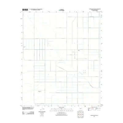
2011 Map of Cortez Peak NW
USGS Topo · Published 2011About this map
Centennial Wash cuts a diagonal path across this desert landscape, dictating the orientation of local infrastructure in an area otherwise defined by a rigid section-line grid. Agricultural activity and rural ranching characterize the mid-20th-century development here, with Centennial Farms and the Desert-Ho Ranch serving as primary landmarks. The presence of Eagletail Ranch Airport and specialized thoroughfares like S El Paso Natural Gas Rd point to the area's integration into regional energy and transport networks. Far removed from the dense urbanization of Phoenix, the map reveals a meticulously surveyed environment of high-numbered avenues and long-distance roads such as Indian School RD and W Baseline RD, supporting isolated water features like Allison Tank in the arid terrain.
Find a feature on this map
37 named features on this map. Tap any name to fly to it.
Don’t see what you’re looking for? This feature index may not catch every label — zoom into the map to look around manually.
Map Details
Editions of this 2011 Cortez Peak NW Map
This is the sole edition of this map. No revisions or reprints were ever made.
Other maps of this area

1942 · Vicksburg
USGS Topo · 1:250,000

1954 · Phoenix
USGS Topo · 1:250,000

1957 · Phoenix
USGS Topo · 1:250,000

1958 · Phoenix
USGS Topo · 1:250,000

1960 · Phoenix
USGS Topo · 1:250,000

1961 · Lone Mountain
USGS Topo · 1:62,500

1961 · Big Horn Mts
USGS Topo · 1:62,500

1962 · Cortez Peak
USGS Topo · 1:62,500

1962 · Eagletail Mts
USGS Topo · 1:62,500

1969 · Phoenix
USGS Topo · 1:250,000