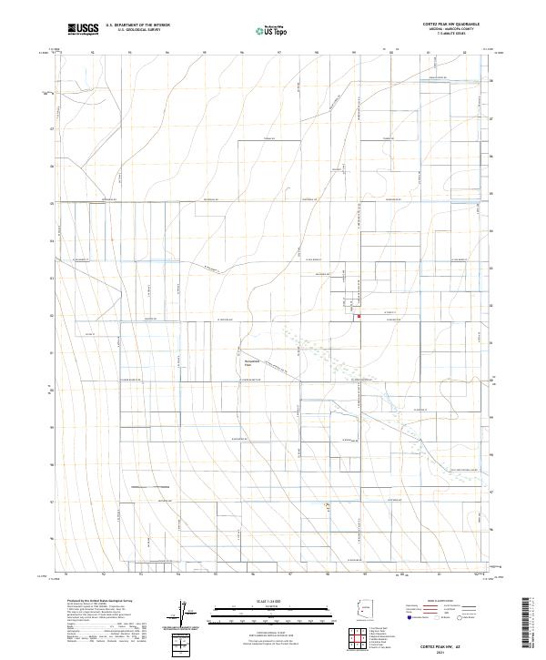
2021 Map of Cortez Peak NW
USGS Topo · Published 2021About this map
Harquahala Plain defines this expanse of western Maricopa County, showing a landscape organized by a rigorous grid of section lines and agricultural roads. By the early 2020s, the area reflects a transitional character where traditional desert terrain meets structured land development. Significant infrastructure like the S El Paso Natural Gas Rd and Harquahala Valley Rd cut across the flats, supporting the energy and transport needs of the region. The ephemeral Centennial Wash meanders through the southern portion of the sheet, providing a natural break in the otherwise geometric survey lines. Settlements like Encanto appear as small pockets of development along major thoroughfares such as Indian School Rd and Courthouse Rd, marking the gradual westward expansion of the valley's residential footprint.
Find a feature on this map
44 named features on this map. Tap any name to fly to it.
Don’t see what you’re looking for? This feature index may not catch every label — zoom into the map to look around manually.
Map Details
Editions of this 2021 Cortez Peak NW Map
This is the sole edition of this map. No revisions or reprints were ever made.
Other maps of this area

1942 · Vicksburg
USGS Topo · 1:250,000

1954 · Phoenix
USGS Topo · 1:250,000

1957 · Phoenix
USGS Topo · 1:250,000

1958 · Phoenix
USGS Topo · 1:250,000

1960 · Phoenix
USGS Topo · 1:250,000

1961 · Lone Mountain
USGS Topo · 1:62,500

1961 · Big Horn Mts
USGS Topo · 1:62,500

1962 · Cortez Peak
USGS Topo · 1:62,500

1962 · Eagletail Mts
USGS Topo · 1:62,500

1969 · Phoenix
USGS Topo · 1:250,000