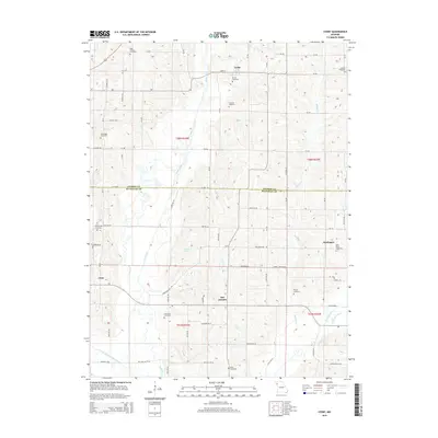
2015 Map of Cosby
USGS Topo · Published 2015About this map
Platte River and the One Hundred and Two River define the agricultural landscape of this Missouri region, marking the transition between Andrew and Buchanan counties. The village of Cosby sits in the north along Main St, while the community of San Antonio occupies the center, and Hurlingen lies to the east near the NE Railroad. This map is particularly valuable for genealogical research, documenting numerous burial sites across the township including High Prairie Cemetery, Brown Cemetery, Concord Cemetery, and Bethel Cemetery. The drainage patterns of Muddy Creek and the Third Fork illustrate the fertile lowlands that supported these long-standing farming communities. Local landmarks like Wales Lake and the Oak Ridge Cemetery offer specific points of reference for tracing family homesteads and local history in a landscape shaped by both small-town settlements and river tributaries.
Find a feature on this map
55 named features on this map. Tap any name to fly to it.
Don’t see what you’re looking for? This feature index may not catch every label — zoom into the map to look around manually.
Map Details
Editions of this 2015 Cosby Map
This is the sole edition of this map. No revisions or reprints were ever made.
Other maps of this area

1923 · Clarksdale
USGS Topo · 1:62,500

1924 · St. Joseph
USGS Topo · 1:62,500

1925 · Gower
USGS Topo · 1:62,500

1925 · Clarksdale
USGS Topo · 1:62,500

1926 · Saint Joseph
USGS Topo · 1:62,500

1927 · Dearborn
USGS Topo · 1:62,500

1950 · Kansas City
USGS Topo · 1:250,000

1954 · Kansas City
USGS Topo · 1:250,000

1956 · Kansas City
USGS Topo · 1:250,000

1960 · Kansas City
USGS Topo · 1:250,000