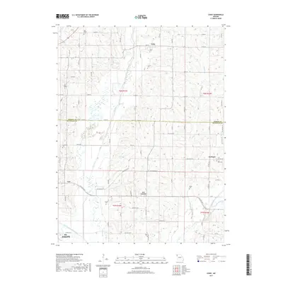
2017 Map of Cosby
USGS Topo · Published 2017About this map
The Platte River meanders through the heart of this landscape, marking the boundary where small farming communities have thrived for generations. Centered on the town of Cosby, this survey illustrates the rural grid of northwestern Missouri as it appeared in the early 21st century. The map is particularly rich for genealogical research, identifying numerous family and community burial grounds such as High Prairie Cem, Brown Cem, and Oak Ridge Cem. In the southern portion of the sheet, the terrain descends toward the St. Joseph city limits, where the One Hundred and Two River meets the local drainage system. Significant local landmarks like Wales Lake and the settlement of San Antonio highlight the distribution of water and commerce across the Andrew and Buchanan county line.
Find a feature on this map
77 named features on this map. Tap any name to fly to it.
Don’t see what you’re looking for? This feature index may not catch every label — zoom into the map to look around manually.
Map Details
Editions of this 2017 Cosby Map
This is the sole edition of this map. No revisions or reprints were ever made.
Other maps of this area

1923 · Clarksdale
USGS Topo · 1:62,500

1924 · St. Joseph
USGS Topo · 1:62,500

1925 · Gower
USGS Topo · 1:62,500

1925 · Clarksdale
USGS Topo · 1:62,500

1926 · Saint Joseph
USGS Topo · 1:62,500

1927 · Dearborn
USGS Topo · 1:62,500

1950 · Kansas City
USGS Topo · 1:250,000

1954 · Kansas City
USGS Topo · 1:250,000

1956 · Kansas City
USGS Topo · 1:250,000

1960 · Kansas City
USGS Topo · 1:250,000