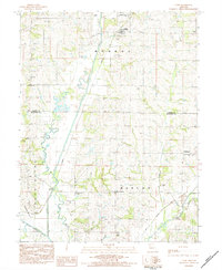
1983 Map of Cosby
USGS Topo · Published 1984About this map
The Platte River meanders through the heart of this Andrew and Buchanan County landscape, defining the boundary between Monroe and Washington townships. The map documents a predominantly agrarian region in the early 1980s, punctuated by small settlements like Cosby, San Antonio, and Hurlingen. A historical transport footprint is visible in the Old Railroad Grade tracing through the southeastern corner near the Third Fork of the Platte.
Find a feature on this map
35 named features on this map. Tap any name to fly to it.
Don’t see what you’re looking for? This feature index may not catch every label — zoom into the map to look around manually.
Map Details
Editions of this 1983 Cosby Map
This is the sole edition of this map. No revisions or reprints were ever made.
Other maps of this area

1923 · Clarksdale
USGS Topo · 1:62,500

1924 · St. Joseph
USGS Topo · 1:62,500

1925 · Gower
USGS Topo · 1:62,500

1925 · Clarksdale
USGS Topo · 1:62,500

1926 · Saint Joseph
USGS Topo · 1:62,500

1927 · Dearborn
USGS Topo · 1:62,500

1950 · Kansas City
USGS Topo · 1:250,000

1954 · Kansas City
USGS Topo · 1:250,000

1956 · Kansas City
USGS Topo · 1:250,000

1960 · Kansas City
USGS Topo · 1:250,000