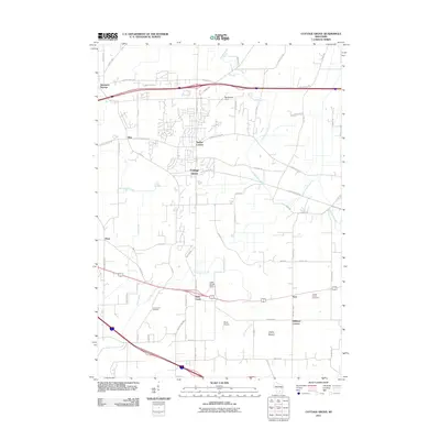
2011 Map of Cottage Grove
USGS Topo · Published 2011About this map
Cottage Grove serves as the central hub of this eastern Dane County landscape in the early twenty-first century, a region defined by its glacial heritage and agricultural roots. The map traces the varied drainage patterns of Door Creek and Koshkonong Creek, while the Glacial Drumlin Trl cuts across the center, following a former rail corridor that once linked these rural communities. Small settlements and named crossroads such as Seminary Springs, Taylors Corners, and Hoffman Corners indicate the historical development of the township. Local landmarks such as Liberty Mound and the Liberty Prairie Cemetery provide points of interest for genealogists and local historians. The presence of Door Creek Orchard and various private airstrips like Quale Airport and Blackhawk Field illustrates the contemporary mix of traditional agriculture and specialized land use common in the Madison periphery.
Find a feature on this map
65 named features on this map. Tap any name to fly to it.
Don’t see what you’re looking for? This feature index may not catch every label — zoom into the map to look around manually.
Map Details
Editions of this 2011 Cottage Grove Map
This is the sole edition of this map. No revisions or reprints were ever made.
Other maps of this area

1889 · Evansville
USGS Topo · 1:62,500

1890 · Madison
USGS Topo · 1:62,500

1890 · Sun Prairie
USGS Topo · 1:62,500

1890 · Stoughton
USGS Topo · 1:62,500

1892 · Madison
USGS Topo · 1:62,500

1894 · Evansville
USGS Topo · 1:62,500

1896 · Sun Prairie
USGS Topo · 1:62,500

1904 · Madison
USGS Topo · 1:62,500

1905 · Sun Prairie
USGS Topo · 1:62,500

1906 · Evansville
USGS Topo · 1:62,500