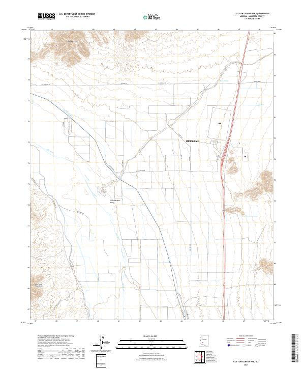
2021 Map of Cotton Center NW
USGS Topo · Published 2021About this map
Buckeye anchors the landscape where the agricultural infrastructure of the Gila Bend Canal meets the natural flow of the Gila River. This western reach of the Salt River Valley shows a transition from structured irrigation and local transport routes like Gilas Ranch Rd to the arid terrain of the Little Rainbow Valley. The surrounding elevations, including the Buckeye Hills to the north and the Gila Bend Mountains in the southwest, define the drainage patterns of the desert floor.
Find a feature on this map
34 named features on this map. Tap any name to fly to it.
Don’t see what you’re looking for? This feature index may not catch every label — zoom into the map to look around manually.
Map Details
Editions of this 2021 Cotton Center NW Map
This is the sole edition of this map. No revisions or reprints were ever made.
Other maps of this area

1951 · Cotton Center
USGS Topo · 1:62,500

1951 · Woolsey Peak
USGS Topo · 1:62,500

1954 · Phoenix
USGS Topo · 1:250,000

1957 · Phoenix
USGS Topo · 1:250,000

1958 · Phoenix
USGS Topo · 1:250,000

1958 · Hassayampa
USGS Topo · 1:24,000

1958 · Buckeye
USGS Topo · 1:24,000

1958 · Buckeye
USGS Topo · 1:62,500

1960 · Phoenix
USGS Topo · 1:250,000

1962 · Arlington
USGS Topo · 1:62,500