
1958 Map of Buckeye
USGS Topo · Published 1963About this map
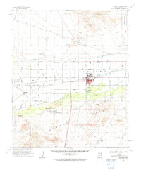
The agricultural landscape of the Gila River Valley is defined by a dense network of irrigation in the late 1950s, centering on the town of Buckeye. To the north, the White Tank Mountains and the White Tank Proving Grounds provide a stark topographical contrast to the valley floor. The map records several small communities and agricultural hubs, including Valencia, Allenville, and Palo Verde, which were linked by the Southern Pacific railroad and an organized grid of section roads like Base Line Road and Southern Avenue. Water management is prominent throughout, with the Roosevelt Canal, Buckeye Canal, and Arlington Canal steering the flow of the Gila River and Hassayampa River toward local fields. Historical researchers will find value in the specific locations of the Blackhawk Mines and the Hazelton Memorial Cem, as well as the early boundaries of the Robbins Butte State Game Management Unit.
Find a feature on this map
48 named features on this map. Tap any name to fly to it.
Don’t see what you’re looking for? This feature index may not catch every label — zoom into the map to look around manually.
Map Details
Editions of this 1958 Buckeye Map
2 editions found
Other maps of this area

1946 · Avondale
USGS Topo · 1:62,500

1948 · Cashion
USGS Topo · 1:62,500

1951 · Mobile
USGS Topo · 1:62,500

1951 · Cotton Center
USGS Topo · 1:62,500

1951 · Woolsey Peak
USGS Topo · 1:62,500

1954 · Phoenix
USGS Topo · 1:250,000

1957 · Phoenix
USGS Topo · 1:250,000

1957 · White Tank Mts. SE
USGS Topo · 1:24,000

1957 · Valencia
USGS Topo · 1:24,000

1957 · Perryville
USGS Topo · 1:24,000