
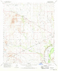
1962 Map of Arlington
USGS Topo · Published 1964About this map
Arlington and the surrounding desert plains of Maricopa County are defined by the convergence of the Gila River and the Hassayampa River in the early 1960s. The landscape reflects a mix of agricultural development and desert land use, with the Arlington Canal and the Hassayampa Cotton Gin supporting local farming while the Southern Pacific railroad cuts through the southern reaches near the Yellow Medicine Hills.
Find a feature on this map
37 named features on this map. Tap any name to fly to it.
Don’t see what you’re looking for? This feature index may not catch every label — zoom into the map to look around manually.
Map Details
Editions of this 1962 Arlington Map
2 editions found
Other maps of this area

1942 · Vicksburg
USGS Topo · 1:250,000

1951 · Dendora Valley
USGS Topo · 1:62,500

1951 · Cotton Center
USGS Topo · 1:62,500

1951 · Woolsey Peak
USGS Topo · 1:62,500

1954 · Phoenix
USGS Topo · 1:250,000

1957 · Phoenix
USGS Topo · 1:250,000

1957 · White Tank Mts.
USGS Topo · 1:62,500

1958 · Phoenix
USGS Topo · 1:250,000

1958 · Buckeye NW
USGS Topo · 1:24,000

1958 · Hassayampa
USGS Topo · 1:24,000