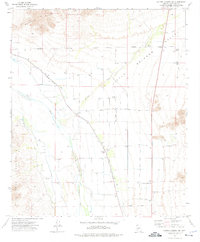
1973 Map of Cotton Center NW
USGS Topo · Published 1976About this map
The Gila River corridor south of the Buckeye Hills is defined here by a complex network of irrigation and desert water management during the early 1970s. The landscape transition from the Gila Mountains into the arid expanse of Little Rainbow Valley is marked by vital agricultural infrastructure, including the Gila Bend Canal, the Old Gila Bend Canal, and the Enterprise Canal. These water systems supported local operations like the Enterprise Ranch and a centralized Cotton Gin accompanied by a Storage Bin. This map captures a specific era of Sonoran Desert land use where numerous named wells, such as Hedges Well, and several Landing Strips provided the necessary connectivity for isolated ranching and farming outposts. The presence of both modern and old canal alignments suggests a history of evolving hydraulic engineering in this corner of Maricopa County.
Find a feature on this map
26 named features on this map. Tap any name to fly to it.
Don’t see what you’re looking for? This feature index may not catch every label — zoom into the map to look around manually.
Map Details
Editions of this 1973 Cotton Center NW Map
This is the sole edition of this map. No revisions or reprints were ever made.
Other maps of this area

1951 · Cotton Center
USGS Topo · 1:62,500

1951 · Woolsey Peak
USGS Topo · 1:62,500

1954 · Phoenix
USGS Topo · 1:250,000

1957 · Phoenix
USGS Topo · 1:250,000

1958 · Phoenix
USGS Topo · 1:250,000

1958 · Hassayampa
USGS Topo · 1:24,000

1958 · Buckeye
USGS Topo · 1:24,000

1958 · Buckeye
USGS Topo · 1:62,500

1960 · Phoenix
USGS Topo · 1:250,000

1962 · Arlington
USGS Topo · 1:62,500