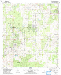
1991 Map of Cotton Plant
USGS Topo · Published 1991About this map
Cotton Plant stands as a central point in this Marion County landscape, situated where local roads converge near St Johns Ch and Wesley Chapel Cem. The area reflects a mix of agricultural roots and modern transition, characterized by the emergence of residential developments like Rainbow Park, Ocala Estates, and Rolling Hills Estates. The equine culture of this region is evidenced by the presence of the Classic Mile Racetrack and Meadow Wood Farm, while the natural geography is defined by numerous depressions and ponds such as Hog Pond and Schoolhouse Pond.
Find a feature on this map
38 named features on this map. Tap any name to fly to it.
Don’t see what you’re looking for? This feature index may not catch every label — zoom into the map to look around manually.
Map Details
Editions of this 1991 Cotton Plant Map
This is the sole edition of this map. No revisions or reprints were ever made.
Other maps of this area

1892 · Dunnellon
USGS Topo · 1:62,500

1893 · Citra
USGS Topo · 1:62,500

1894 · Dunnellon
USGS Topo · 1:62,500

1895 · Williston
USGS Topo · 1:62,500

1895 · Citra
USGS Topo · 1:62,500

1895 · Ocala
USGS Topo · 1:62,500

1954 · Romeo
USGS Topo · 1:24,000

1954 · Dunnellon
USGS Topo · 1:24,000

1954 · Cotton Plant
USGS Topo · 1:24,000

1954 · Dunnellon SE
USGS Topo · 1:24,000