
1954 Map of Romeo
USGS Topo · Published 1955About this map
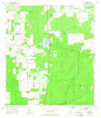
The boundary between Levy County and Marion County runs through this mid-century landscape of wet prairies and sinkhole ponds. The small community of Romeo serves as a central point along the Atlantic Coast Line, which cuts vertically through the center of the sheet. To the west, the landscape is defined by vast open areas like Pine Island Prairie and Dry Cow House Prairie, interspersed with dozens of localized water features including Kitchen Cow House Pond and Dinner Sink Pond. Local community life is anchored at the Zion Hill Ch and its adjacent Zion Hill Cem. The eastern portion of the map is traversed by the Seaboard Air Line railroad, passing through the settlement of Hoyt. This era captures a period where traditional rail transport still dictated the local geography of North Central Florida, linking isolated homesteads and small mines to larger markets.
Find a feature on this map
18 named features on this map. Tap any name to fly to it.
Don’t see what you’re looking for? This feature index may not catch every label — zoom into the map to look around manually.
Map Details
Editions of this 1954 Romeo Map
2 editions found
Other maps of this area

1892 · Dunnellon
USGS Topo · 1:62,500

1894 · Dunnellon
USGS Topo · 1:62,500

1895 · Williston
USGS Topo · 1:62,500

1954 · Dunnellon
USGS Topo · 1:24,000

1954 · Cotton Plant
USGS Topo · 1:24,000

1954 · Dunnellon SE
USGS Topo · 1:24,000

1954 · Yankeetown SE
USGS Topo · 1:24,000

1954 · Dunnellon
USGS Topo · 1:62,500

1954 · Gainesville
USGS Topo · 1:250,000

1955 · Tidewater
USGS Topo · 1:24,000