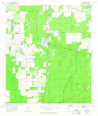
1954 Map of Romeo
USGS Topo · Published 1966About this map
Romeo stands as a primary rail junction in the mid-1950s, where the Atlantic Coast Line and Seaboard Air Line railroads intersect among the prairies of Marion County. This landscape is defined by its unusual hydrology, featuring numerous named depressions and sinks such as Dinner Sink Pond, Dry Cow House Pond, and Kitchen Cow House Pond. These water bodies are scattered across open expanses like Pine Island Prairie, illustrating the porous limestone geology of the Florida interior.
Find a feature on this map
20 named features on this map. Tap any name to fly to it.
Don’t see what you’re looking for? This feature index may not catch every label — zoom into the map to look around manually.
Map Details
Editions of this 1954 Romeo Map
2 editions found
Other maps of this area

1892 · Dunnellon
USGS Topo · 1:62,500

1894 · Dunnellon
USGS Topo · 1:62,500

1895 · Williston
USGS Topo · 1:62,500

1954 · Romeo
USGS Topo · 1:24,000

1954 · Dunnellon
USGS Topo · 1:24,000

1954 · Cotton Plant
USGS Topo · 1:24,000

1954 · Dunnellon SE
USGS Topo · 1:24,000

1954 · Yankeetown SE
USGS Topo · 1:24,000

1954 · Dunnellon
USGS Topo · 1:62,500

1954 · Gainesville
USGS Topo · 1:250,000