
1954 Map of Yankeetown SE
USGS Topo · Published 1955About this map
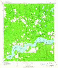
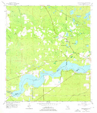
The Withlacoochee River dominates the southern landscape of this 1954 survey, defining the border where Levy, Citrus, and Marion counties meet. This region is characterized by a complex network of wetlands and hammocks, such as Cedar Hammock and Little Cedar Hammock, punctuated by numerous isolated water bodies including Salt Sick Lake and Blackwater Lake. The drainage pattern is led by Horse Hole Creek and the Bell Branch, which wind through the low-lying terrain of Hellcat Bay and Big Bay.
Find a feature on this map
31 named features on this map. Tap any name to fly to it.
Don’t see what you’re looking for? This feature index may not catch every label — zoom into the map to look around manually.
Map Details
Editions of this 1954 Yankeetown SE Map
3 editions found
Other maps of this area

1892 · Dunnellon
USGS Topo · 1:62,500

1894 · Dunnellon
USGS Topo · 1:62,500

1895 · Tsala Apopka
USGS Topo · 1:62,500

1954 · Holder
USGS Topo · 1:24,000

1954 · Crystal River
USGS Topo · 1:24,000

1954 · Romeo
USGS Topo · 1:24,000

1954 · Dunnellon
USGS Topo · 1:24,000

1954 · Red Level
USGS Topo · 1:24,000

1954 · Inverness
USGS Topo · 1:62,500

1954 · Dunnellon
USGS Topo · 1:62,500