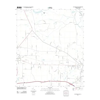
2012 Map of Cottondale East
USGS Topo · Published 2012About this map
Waddells Mill and its associated waterworks anchor the northern landscape of this Jackson County region, where the hydrology of the Chipola River basin has long defined local industry and movement. The presence of numerous named water bodies, including Waddells Mill Pond, Williams Mill Pond, and Caraway Mill Pond, suggests a historical reliance on these drainages for mill operations and agriculture. The landscape is also dotted with natural springs such as Webbville Spring and Tanner Springs, which likely served as vital landmarks and water sources for early settlers. Transportation routes like Christoff Ferry Ln and the iconic Bellamy Bridge illustrate how residents navigated the riverine environment. On higher ground, the Marianna Fire Control Headquarters Fire Tower stands as a notable sentinel for forest management in this rural Florida corridor.
Find a feature on this map
104 named features on this map. Tap any name to fly to it.
Don’t see what you’re looking for? This feature index may not catch every label — zoom into the map to look around manually.
Map Details
Editions of this 2012 Cottondale East Map
This is the sole edition of this map. No revisions or reprints were ever made.
Other maps of this area

1952 · Oakdale
USGS Topo · 1:24,000

1952 · Kynesville
USGS Topo · 1:24,000

1952 · Cottondale East
USGS Topo · 1:24,000

1952 · Malone
USGS Topo · 1:24,000

1952 · Campbellton
USGS Topo · 1:24,000

1952 · Cottondale West
USGS Topo · 1:24,000

1952 · Sills
USGS Topo · 1:24,000
1952 · Alford
USGS Topo · 1:24,000

1952 · Marianna
USGS Topo · 1:24,000

1954 · Tallahassee
USGS Topo · 1:250,000