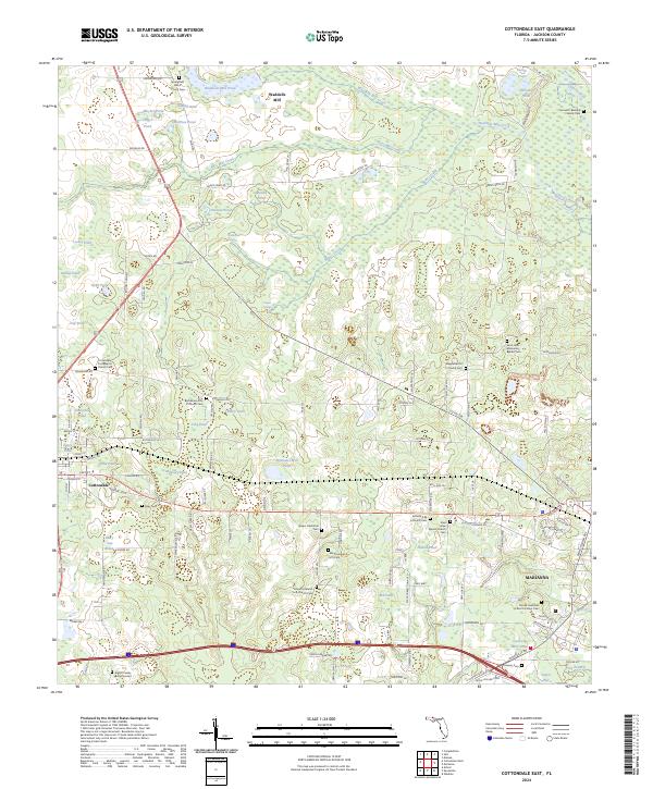
2024 Map of Cottondale East
USGS Topo · Published 2024About this map
Cottondale and the western edge of Marianna anchor this Jackson County landscape, characterized by a dense network of family cemeteries and historic African Methodist Episcopal (AME) churches. The northern reaches are defined by the Upper Chipola River and Waddells Mill Creek, where the local industrial legacy is preserved at Waddells Mill. Genealogists will find significant value in the numerous burial sites across the township, including the Samuel C Bellamy Family Cem and the Everitt Family Burial Ground.
Find a feature on this map
116 named features on this map. Tap any name to fly to it.
Don’t see what you’re looking for? This feature index may not catch every label — zoom into the map to look around manually.
Map Details
Editions of this 2024 Cottondale East Map
This is the sole edition of this map. No revisions or reprints were ever made.
Other maps of this area

1952 · Oakdale
USGS Topo · 1:24,000

1952 · Kynesville
USGS Topo · 1:24,000

1952 · Cottondale East
USGS Topo · 1:24,000

1952 · Malone
USGS Topo · 1:24,000

1952 · Campbellton
USGS Topo · 1:24,000

1952 · Cottondale West
USGS Topo · 1:24,000

1952 · Sills
USGS Topo · 1:24,000
1952 · Alford
USGS Topo · 1:24,000

1952 · Marianna
USGS Topo · 1:24,000

1954 · Tallahassee
USGS Topo · 1:250,000