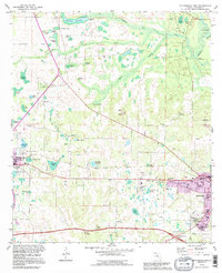
1994 Map of Cottondale East
USGS Topo · Published 1995About this map
Waddells Mill and the surrounding millponds anchor a landscape defined by an intricate network of water features and agricultural history. This Jackson County landscape features numerous family-named basins, including Snelling Pond, Roulhac Pond, and Jenkins Pond, indicating a long history of private landownership and resource management. The 1990s revisions highlight the expansion of Marianna toward the east, showing the encroachment of modern utilities like the Substation and Radio Towers (WJCL) on formerly rural land.
Find a feature on this map
67 named features on this map. Tap any name to fly to it.
Don’t see what you’re looking for? This feature index may not catch every label — zoom into the map to look around manually.
Map Details
Editions of this 1994 Cottondale East Map
This is the sole edition of this map. No revisions or reprints were ever made.
Other maps of this area

1952 · Oakdale
USGS Topo · 1:24,000

1952 · Kynesville
USGS Topo · 1:24,000

1952 · Cottondale East
USGS Topo · 1:24,000

1952 · Malone
USGS Topo · 1:24,000

1952 · Campbellton
USGS Topo · 1:24,000

1952 · Cottondale West
USGS Topo · 1:24,000

1952 · Sills
USGS Topo · 1:24,000
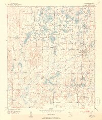
1952 · Alford
USGS Topo · 1:24,000

1952 · Marianna
USGS Topo · 1:24,000

1954 · Tallahassee
USGS Topo · 1:250,000