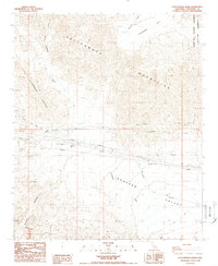
1988 Map of Cottonwood Basin
USGS Topo · Published 1988About this map
Cottonwood Mountains and the Little San Bernardino Mountains dominate this arid landscape, where the Colorado River Aqueduct and Colorado River Tunnel trace a vital path through the desert. This 1980s-era record of the Coachella Valley's eastern periphery captures the infrastructure required to sustain life and travel in the region, including the Cactus City Rest Area, Sewage Disposal Ponds, and various pipelines. To the north, the protected land of the Joshua Tree National Monument Wilderness meets the Cottonwood Basin, while the southern terrain transitions into the deeply eroded topography of Painted Canyon and the Mecca Hills. The map clearly illustrates the convergence of drainage systems like Pinkham Wash into the broad expanse of Shavers Valley, reflecting the complex hydrology of the Colorado Desert.
Find a feature on this map
17 named features on this map. Tap any name to fly to it.
Don’t see what you’re looking for? This feature index may not catch every label — zoom into the map to look around manually.
Map Details
Editions of this 1988 Cottonwood Basin Map
2 editions found
Other maps of this area

1904 · Indio
USGS Topo · 1:125,000

1940 · Cottonwood Spring
USGS Topo · 1:62,500

1941 · Coachella
USGS Topo · 1:62,500

1943 · Coachella
USGS Topo · 1:62,500

1943 · Pinkham Well
USGS Topo · 1:62,500

1944 · Cottonwood Spring
USGS Topo · 1:62,500

1944 · Pinkham Well
USGS Topo · 1:62,500

1944 · Pinyon Well
USGS Topo · 1:62,500

1947 · Santa Ana
USGS Topo · 1:250,000

1949 · Santa Ana
USGS Topo · 1:250,000