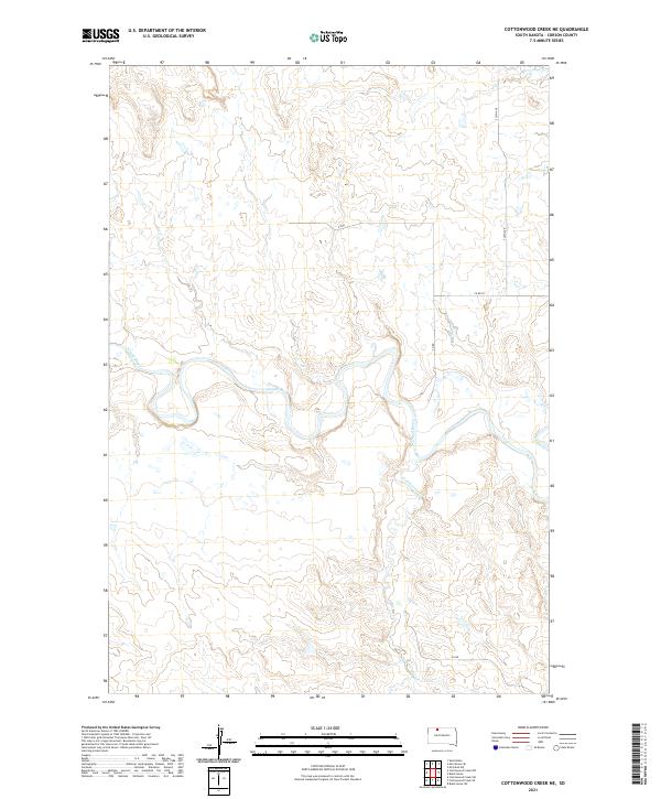
2021 Map of Cottonwood Creek NE
USGS Topo · Published 2021About this map
The Grand River meanders sharply across this central Corson County landscape, defining the topography of the northern Great Plains. This 2021 survey by the U.S. Geological Survey details a sparsely populated ranching and agricultural region where water access and section-line roads dictate the layout of the land. In the northern reaches, Dirt Lodge Cr cuts through the high plains, while Cottonwood Cr enters from the south to join the primary river system. The map illustrates a strict grid of rural infrastructure, including 230th Ave and various segments of Co Rd, which provide the primary transit network for the isolated homesteads and land tracts within the Standing Rock Reservation area.
Find a feature on this map
12 named features on this map. Tap any name to fly to it.
Don’t see what you’re looking for? This feature index may not catch every label — zoom into the map to look around manually.
Map Details
Editions of this 2021 Cottonwood Creek NE Map
This is the sole edition of this map. No revisions or reprints were ever made.
Other maps of this area

1953 · McIntosh
USGS Topo · 1:250,000

1956 · Black Horse SW
USGS Topo · 1:24,000

1956 · Cottonwood Creek NE
USGS Topo · 1:24,000

1956 · Black Horse
USGS Topo · 1:24,000

1956 · Cottonwood Creek SE
USGS Topo · 1:24,000

1956 · Cottonwood Creek NW
USGS Topo · 1:24,000

1956 · Cottonwood Creek SW
USGS Topo · 1:24,000

1958 · McIntosh
USGS Topo · 1:250,000

1972 · McIntosh SW
USGS Topo · 1:24,000

1972 · Morristown SE
USGS Topo · 1:24,000