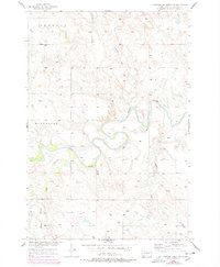
1956 Map of Cottonwood Creek NW
USGS Topo · Published 1978About this map
The Grand River meanders sharply through this 1956 landscape within the Standing Rock Indian Reservation, its winding course defining the geography of southern Corson County. The terrain is characterized by the upland plateaus of Sherman and Riverside, which rise above the drainage networks of Cedar Boy Creek and Meadow Creek. This mid-century survey, based on aerial photography from the development of the Missouri River Basin, reveals a sparsely settled region where the small cluster at Wagner and isolated homesteads rely on the natural contours of the valley. To the south, Black Horse Creek feeds into the rugged breaks, illustrating the complex hydrology that influenced movement and settlement patterns long before modern irrigation changed the basin.
Find a feature on this map
10 named features on this map. Tap any name to fly to it.
Don’t see what you’re looking for? This feature index may not catch every label — zoom into the map to look around manually.
Map Details
Editions of this 1956 Cottonwood Creek NW Map
2 editions found
Other maps of this area

1953 · McIntosh
USGS Topo · 1:250,000

1956 · Cottonwood Creek NE
USGS Topo · 1:24,000

1956 · Cottonwood Creek SE
USGS Topo · 1:24,000

1956 · Cottonwood Creek NW
USGS Topo · 1:24,000

1956 · Cottonwood Creek SW
USGS Topo · 1:24,000

1958 · McIntosh
USGS Topo · 1:250,000

1972 · Morristown SE
USGS Topo · 1:24,000

1972 · Skull Butte
USGS Topo · 1:24,000

1972 · Thunder Hawk SE
USGS Topo · 1:24,000

1972 · Twin Butte
USGS Topo · 1:24,000